“In every walk with nature, one receives far more than he seeks.”—John Muir
“If you are seeking creative ideas, go out walking. Angels whisper to a man when he goes for a walk.”—Raymond Inmon
“If you like hiking, you should try my favorite trail.” I was talking to a vivacious, young saleslady in a store in Charlottesville. VA. She was one year older than my own 18-year-old daughter, and her co-worker was the exact same age. Her expressive eyes communicated almost as much as her words.
“My first semester this past year started off rough. I remember going to my advisor’s office and crying, feeling as if I would never make it in college.” She went on to explain that a few weeks later, she landed a part-time job and was then able to have a car on-campus.
“Once I had my car, I was able to leave campus and explore the Charlottesville area.” Continuing, she explained that it was through one of her weekend excursions that she found what she referred to as her, “favorite hiking trail and swimming hole.” She called it, the “Sugar Hollow trail,” but my husband, John, and I would later learn its actual name is the Moorman’s River trail, near Sugar Hollow.
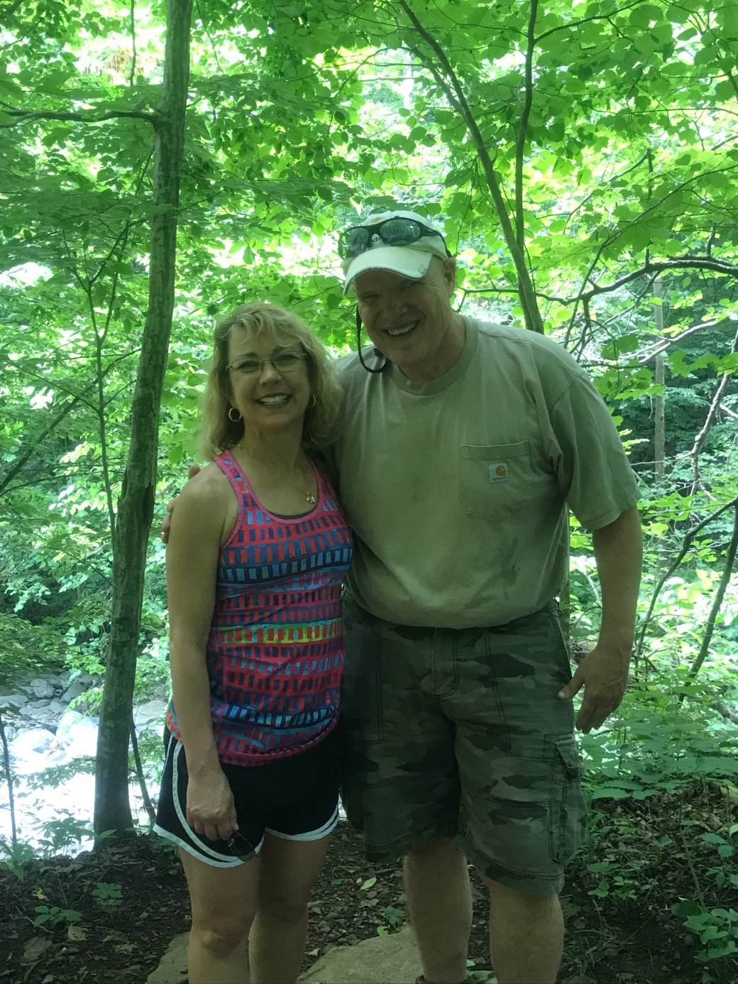
John and I were staying in Charlottesville, VA in June of 2017 celebrating the 28th anniversary of our wedding. The week in which we stayed was hot and humid—with temperatures soaring into the 90s, while lows merely dipped into the 70s, and thunderstorms occurred each afternoon/evening. The morning prior to this conversation, John and I had traversed along the Rivanna Trail for a round-trip hike of approximately ten miles, and we were up for a new challenge!
After talking it over, we decided that Sugar Hollow, aka Moorman’s River trail, sounded right up our alley. Described by our young friend as possessing several waterfalls, swimming holes, and picturesque scenery, John and I were super pumped. We both feel renewed and close to God anytime we are out in the woods and/or near water, especially wooded waterways. Searching on our Google maps and Waze GPS apps, we found a location for Sugar Hollow, so we thought we were all set!
Jetting off the next morning on I-64 towards Crozet, VA, John and I believed with our trusty map apps in hand, all was good. Crozet itself is an adorable, clean, quaint looking town, we observed, as we made our way along the winding roads to what we thought was our hiking destination. The drive itself was stunning. Beautiful roadside vistas, rolling cattle farms, and charming wine vineyards zoomed past us on twisty-turny country roads. Eventually, we no longer had cell phone service, and my Google maps app quit working on my phone; however, John’s Waze app fortunately continued working.
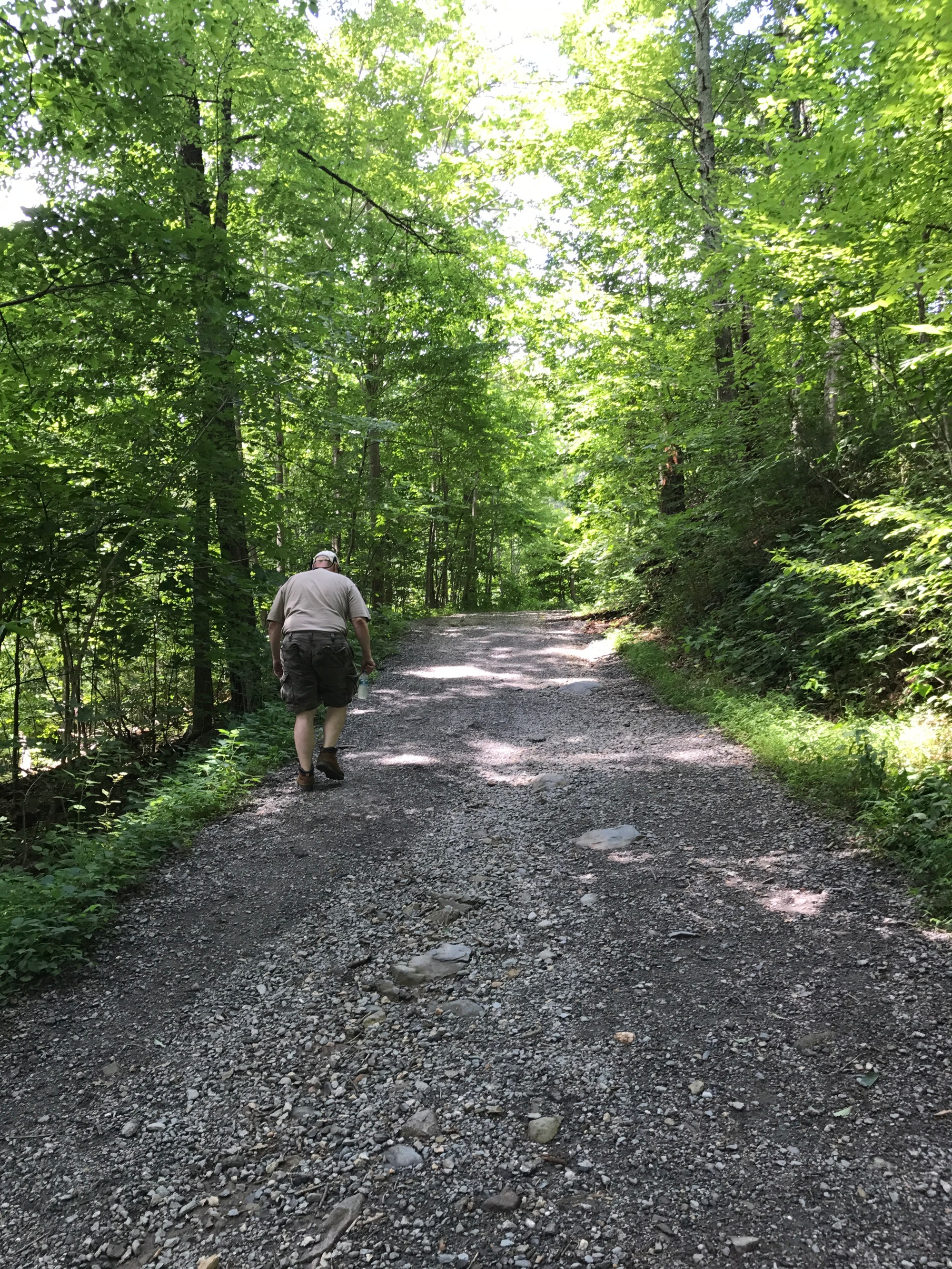
Soon the road narrowed greatly, and the pavement began to look worn. Before long, we were driving along a mixture of gravel/dirt road. We were following the Moorman River, an ambling, rocky river that looked like trout/fly-fishing waters with its rocky bottom, shallow waters as well as here and there waterfalls. We drove past a camp called, The Living Earth School, which appeared to be currently in use as a summer day camp. Continuing on down the dirt path, we passed the Sugar Hollow Inn, a beautiful bed and breakfast in the middle of a mountain/river valley. Finally, the Waze app said we had arrived.
Parking the car in what appeared to be a parking lot and walking around, we found a sign that stated we were at the Sugar Hollow Dam and Reservoir. (We later learned this dam was scenery for the beginning of the of the movie, Evan Almighty. Who knew?) Searching all around, we never found what appeared to be a trailhead. Long story, longer, we decided to drive a few miles back to the camp. Lo and behold, one helpful camp counselor sent us right back in the direction from which we came! As it turned out, when we were at the dam, we were only a short distance away from the trailhead!
Apparently, at one time, there were two parking areas for this popular outdoor adventure area; however, there is now only one, and it was packed when we arrived. That said, for as many cars as we saw—we did not encounter what we would consider a large number of people that day. Further, the hikers we did encounter spanned the age bracket from preschoolers to senior adults and all ages in between. Additionally, the hikers we met, as a general rule, were friendly, helpful, and courteous.


The hike itself is 4.5 miles or so. The elevation change is 460 to 625 feet—depending upon the source referenced. John and I agreed the path could best be described as gently sloping. Our heart rates were elevated, but steady throughout the hike; and, we were never huffing or puffing as often happens on steep incline trails. The challenge came with stream crossings. We encountered three crossings in which we either had to choose to wade the water, or balance-step from one rock to the next across the stream—which is what we did until the third crossing. At the third, and final, crossing, there was no way to avoid getting our feet submerged in the water; and, while John was wearing waterproof boots, my hiking shoes were only water resistant. Therefore, we made the choice to skip the last short leg of the hike because the idea of finishing the trail, walking back through the water, and then continuing the rest of the way down hill with wet feet sounded like an excellent invitation to blisters!
Nonetheless, this trail was fairly easy to navigate and certainly well maintained. In fact, I would call it pleasing as we hiked along to the continuous musical sound of flowing water. Additionally, there was indeed one swimming hole along this trail that seemed fairly popular with young families, teens, and young-adults. Furthermore, on this particular day, the trail was teeming with a multitude of butterflies of all sizes and colors. These ethereal creatures flitted, floated, and fluttered along the path and nearby wooded area. At times, it felt as if John and I were experiencing an otherworldly hike; and at any time, we might encounter a fairy, nymph or elf. (Perhaps, this is a sign I have an overactive imagination!)


In conclusion, John and I most certainly hope to return to this trail. It is a superb trail for those who enjoy beautiful scenery, a shaded path, the sound of babbling water, and a doable hike that isn’t super difficult, but definitely nourishing for soul. Next time, however, waterproof shoes, hiking poles (for balancing over rocky stream crossings), and bug spray will certainly be on the list of required attire/accessories! In the meantime, we highly recommend this trail to healthy hikers of all ages!

I feel like I have already read about this area in Rita Mae Brown’s books set around Crozet. It sounds so serene and beautiful even if I never am able to walk the trail…I did with you and John.
LikeLiked by 1 person