“With its dramatic overlook, Raven Rock has long been an attraction for area residents and visitors. Its history is legendary, with some stories placing, at various moments in time, Daniel Boone and Tecumseh at its edge, 500 feet above the Ohio River.”–Andrew Lee Feight, Ph.D.
He asked me, but if my answer surprised him, he didn’t show it.
Our 33rd wedding anniversary was fast approaching, and John, my husband, asked what I wanted to do in honor of it. Go hiking, of course! I know, not the most logical, or necessarily romantic choice, but it is something special we typically do out-of-town. If we love hiking at destination locations, why not also start hiking more often closer to home? After all, after 33 years together, as the saying goes, “We’re not getting any younger!”
The more we talked about it, the more we embraced the idea. Within an hour to two drive of our home, there are an abundance of trails that we have not explored. Why not take more frequent mini-staycations and enjoy the great outdoors together? While there is definitely some cost in gas, especially given the current prices, hiking closer to home is an overall more cost effective experience when compared to traveling hundreds of miles.
Our destination? Raven Rock State Nature Preserve. This was a trail I had previously hiked a few years ago with my dad as seen here Ravens Rock Trail, Portsmouth, OH – Steph Simply. The thing I remembered most about it was the rewarding spectacular view at the top of this trail after a strong uphill effort. If I remember correctly, Dad and I walked to the edge of the rock, collectively inhaled, and exclaimed, “Wow!” I hoped John would have that kind of experience too.

Unfortunately, John had a meniscectomy in August, so I knew his knee would be fragile on this trail. I wasn’t sure if he would feel up to it, but he gladly agreed to the hike as long as he could take as many breaks as his knee demanded. Breaks, schmakes, I don’t mind those when I get to hang out with Mother Nature!

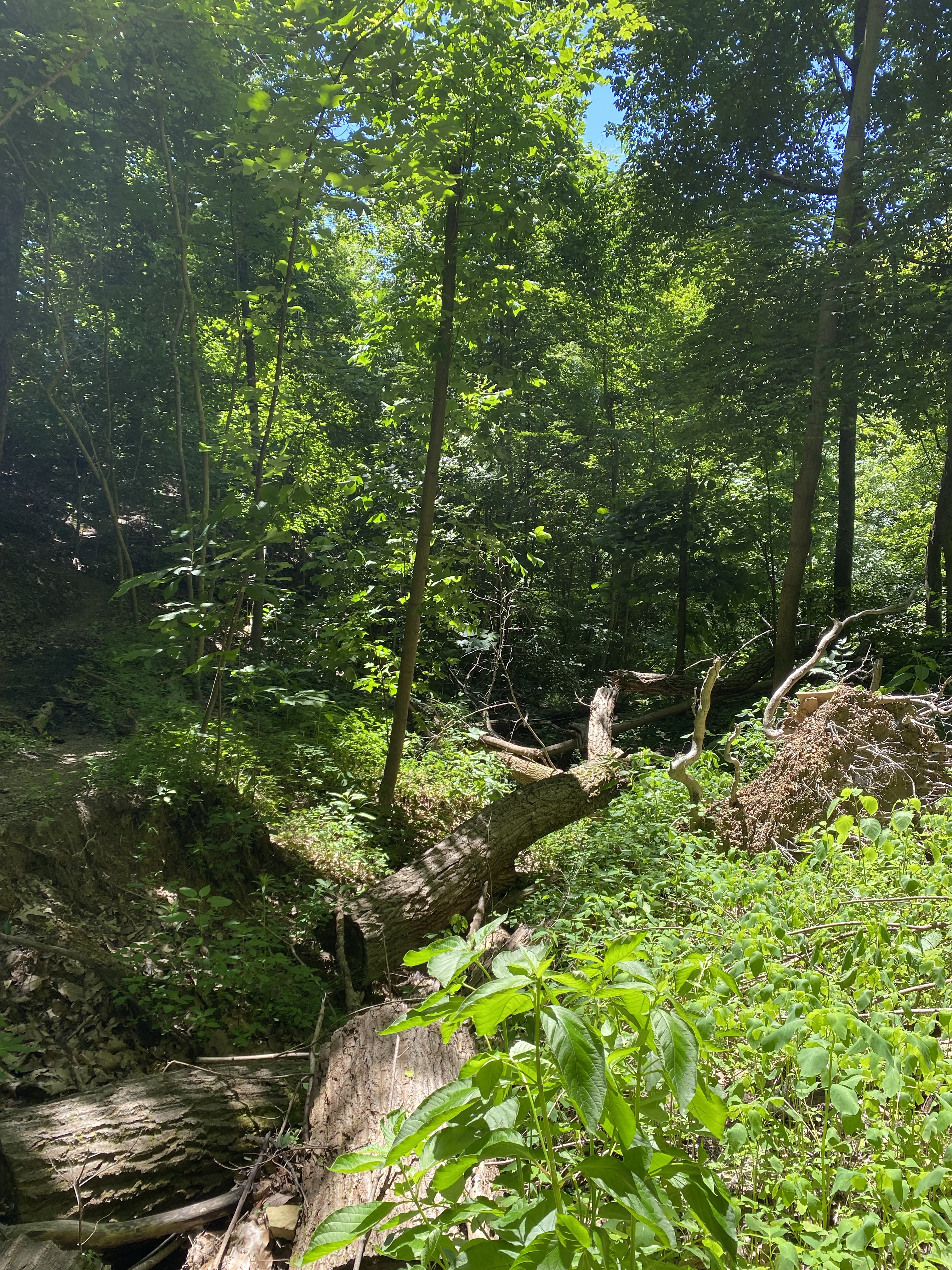
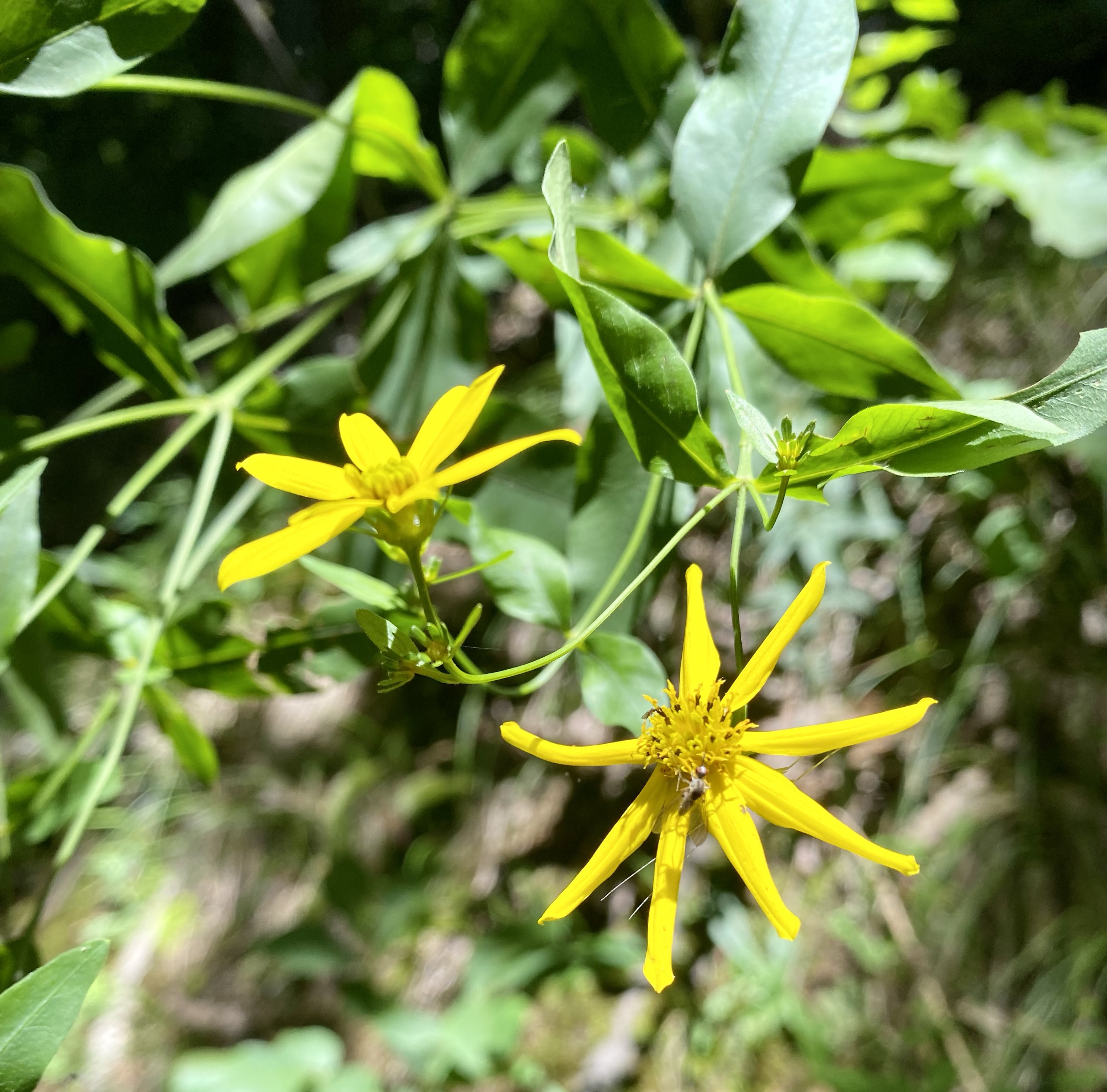


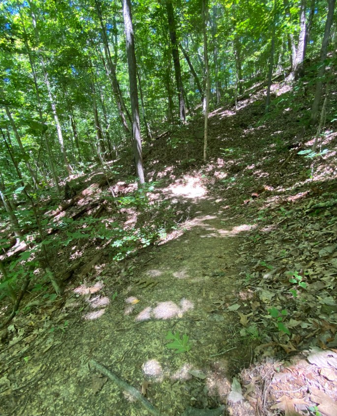
A few images of Mother Nature along the way.
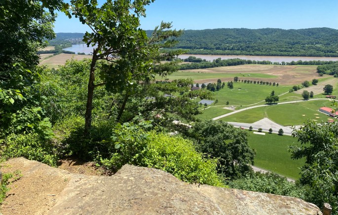
That said, the trail involves several switchbacks with anywhere from an 8% grade to a 28% grade in some parts of the heavily forested trail. In fact, according to Natural Ohio Adventures, Raven Rock trail may be the only trail in Ohio that has an elevation gain similar to a Rocky Mountain trail. The same website also states that no other known Ohio overlook is more elevated than Raven Rock.
Depending upon the source, there are a couple of different reasons as to why Raven Rock was named as such. One account, according to an article by Andrew Lee Feight, Ph.D., describes the romantic tale that a long ago native warrior, named Raven, once jumped to his death from the rock ledge, rather than surrender to enemy hands. However, most sources note that when looking at the rock from above, the central overhanging rock looks like that of a raven’s head and beak while the rest of the rock appears to be its outstretched wings.
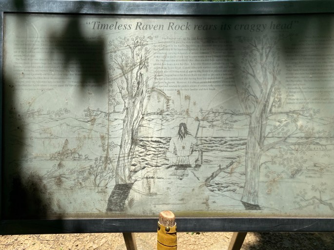
Historically speaking, there seems to be general consensus that Raven Rock would have been an overlook used by native people, such as the Cherokee and Shawnee. As the faded marker at the top of the trail indicates, there must have been countless natives who observed European settlers traveling on the river encroaching upon their original lands. What must these unknown original people have felt? Did they, in fact, use that overlook as a place for planning attacks in an attempt to prevent these strangers from taking land that rightfully belonged to them? One can only speculate.

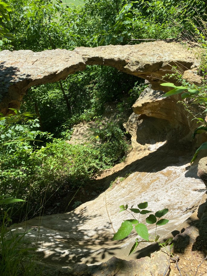
Raven Rock, according to the Ohio Department of Natural Resources, is composed of Missisiipian age sandstone. The weathering of the sandstone over the years has created three naturally occurring rock arches. The largest arch, Raven Rock Arch, is over ten feet long.

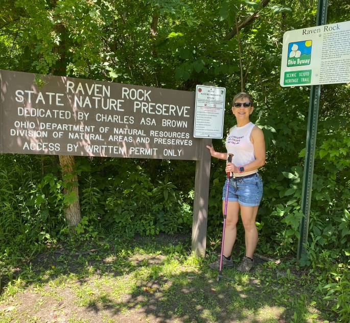
Raven Rock preserve is home to the rare and potentially threatened Blackjack Oak tree (Quercus Marilandica) and a state endangered plant, Small-flowered Scorpionweed – Phacelia dubia. Therefore, this trail, and the land around it, is considered quite fragile. Ohio requests that hikers obtain a permit before exploring the trail which can be completed online in advance. I did read that hikers can also obtain permits at Shawnee State Park, but I am not sure about this point.
As John and I headed up the trail, the skies were bluebird clear, and the temperatures were pleasant. There had been strong thunderstorms that had moved through the area the night before, which had fortunately broken a heat wave, but had unfortunately left thick, muddy sections along the path. Those slippery, mucky spots, however, were few and far between, mostly located near the bottom of the trail.
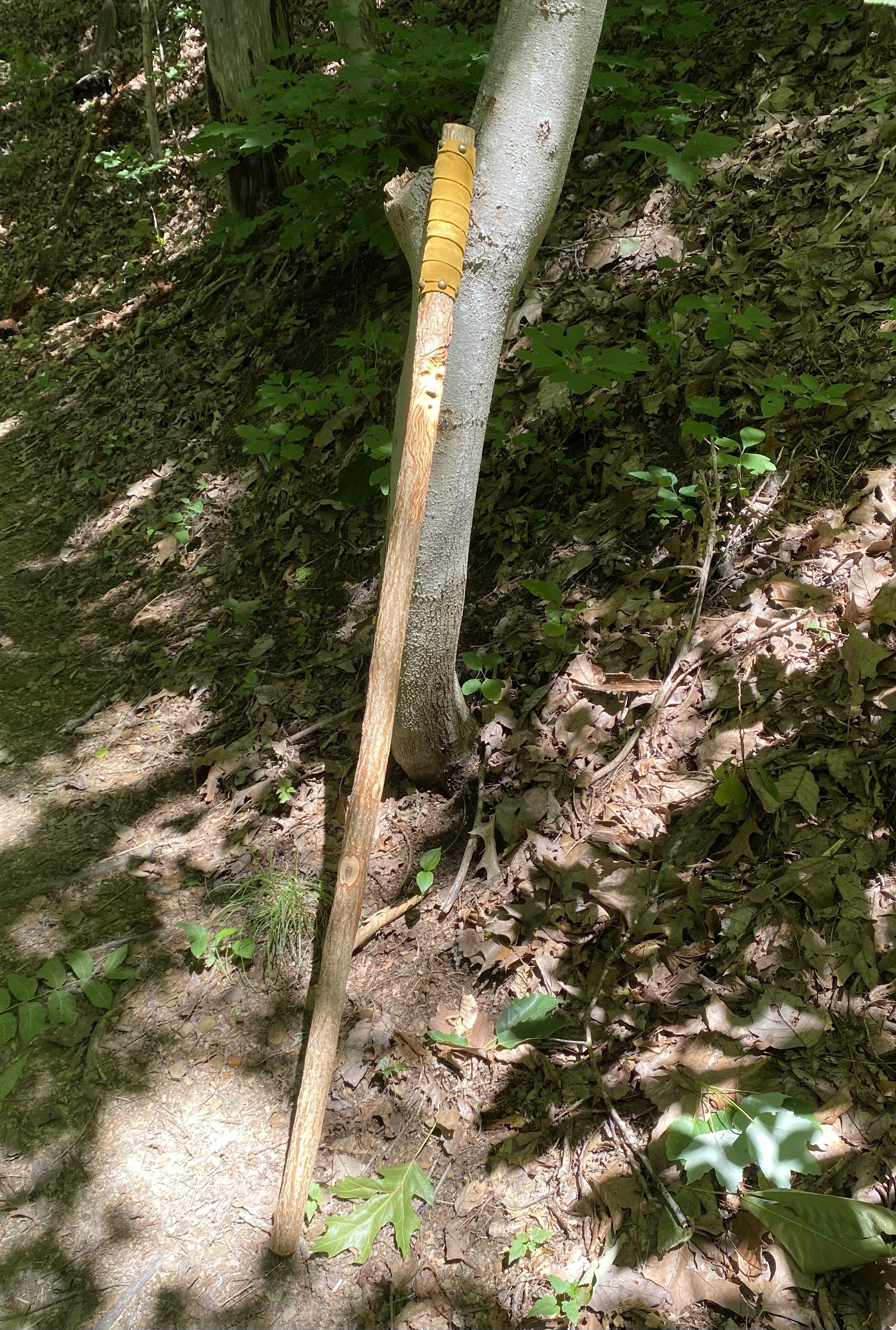
We both hiked with walking stick/pole for the first time, and we found them to be quite helpful for balance in several of the more rocky and steep areas. They were also helpful both moving uphill and downhill as well as for creating an awareness of the edge of the trail/cliff.

There were no trail markers that we could see, aside from the entrance sign, but the trail was easy enough to follow as it was a well-worn path. A couple sections of the trail, we noticed, were beginning to wash away, but there were no confusing portions leaving us wondering which way to go. Even though the trail is steep, it does seem to alternate between segments that are less steep and more steep, giving hikers ample time to catch your breath on the 1.25 mile ascent.

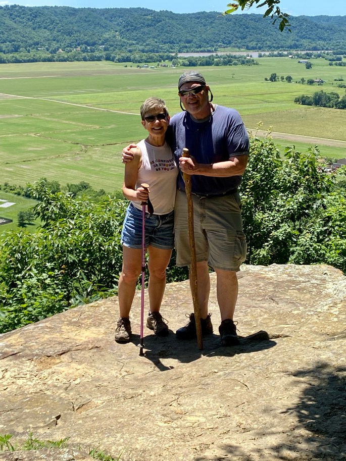
The view was as spectacular as I remembered it! Overlooking the confluence of the Scioto and Ohio Rivers, as well as all the surrounding hills, farmland, and community, the panoramic view was spectacular, especially on this clear day. John and I discussed how gorgeous the precipice must be in full autumn colors or even in the winter, once the leaves have fallen.

One safety point: There is no guard rail, so hikers must be careful walking the edge of Raven Rock. Nonetheless, you can stand or sit at a safe distance from the edge and take in miles of landscape and riverview. However, for those with a healthy fear of heights, there is a bench, at a safe distance, on which you can sit and take in most of the vantage point.

If you like to hike and appreciate a scenic perspective, then Raven Rock Nature Preserve is a trail John and I recommend you explore. According to two respected hiking sites, the trail is rated as an intermediate or moderate level due to its inclines. While we do agree with that assessment, we also believe it would be doable for any level of hikers as long as you take breaks as needed and definitely bring a bottle of water–uphill hiking makes you very thirsty!
Here’s to the wonders of the trail and Mother Nature!